Yosemite National Park is the 3rd national park in USA with amazing granite cliffs, waterfalls, giant sequoia groves, glaciers, mountains and lakes. **Yosemite National Park ** is located in Sierra Nevada, California, a mountain range that stretches over 400 miles.
Yosemite National Park Address: Tioga Rd Hwy 120 & Hwy 140 Yosemite National Park, CA 95389
A bit of history:
Yosemite National Park was inhabited by the Paiute and Sierra Miwok people.These tribes lived in this lush California region for years until white settlers began exploring the area. In 1851, the United States Army chased 200 Ahwahneechees out of Yosemite during the Mariposa Wars. This battle led to more people entering the valley and taking over the land. After the battles, Dr. Lafayette Bunnell documented his experience while in the mountainous region and named his book The Discovery of the Yosemite. Bunnell is known for naming the region “Yosemite”. In 1855, the first tourists arrived in Yosemite, taking numerous photographs and creating beautiful drawings of the land, which were widely distributed. Shortly after, more and more people started visiting Yosemite, which became a National Park in 1916.
Major attractions in the area:
- Washburn Point
- Glacier Point
- Yosemite Tunnel View
- Cooks Meadow
- Yosemite Falls
- El Capitan Meadow
- Yosemite Valley View
Washburn Point
Washburn point is on the way and a mile before Glacier point. Washburn Point provides a beautiful and distinct view of Half Dome. While Glacier Point is more straight on, Washburn Point is a little more to the side, so the dome is not as defined as you would expect it to be.

Glacier Point
Glacier Point is the most famous and unobstructed viewpoint, about an hour’s drive from the valley and you are practically right across from Half Dome itself. Located on the south wall of Yosemite Valley, the overlook rises to an elevation of 7, 214 feet with great views of Half Dome, Yosemite Falls, Vernal Fall (a 317-foot waterfall) and Nevada Fall (594 feet).
If you walk just a short distance down the Panorama Trail, you might have this epic view, which also includes Vernal and Nevada Falls, almost all to yourself. Full moon nights are a magical time to visit Glacier Point, where John Muir and US President Teddy Roosevelt once camped out. Note that the Glacier Point Road is usually closed beyond the Yosemite Ski & Snowboard Area from November until late May or early June.
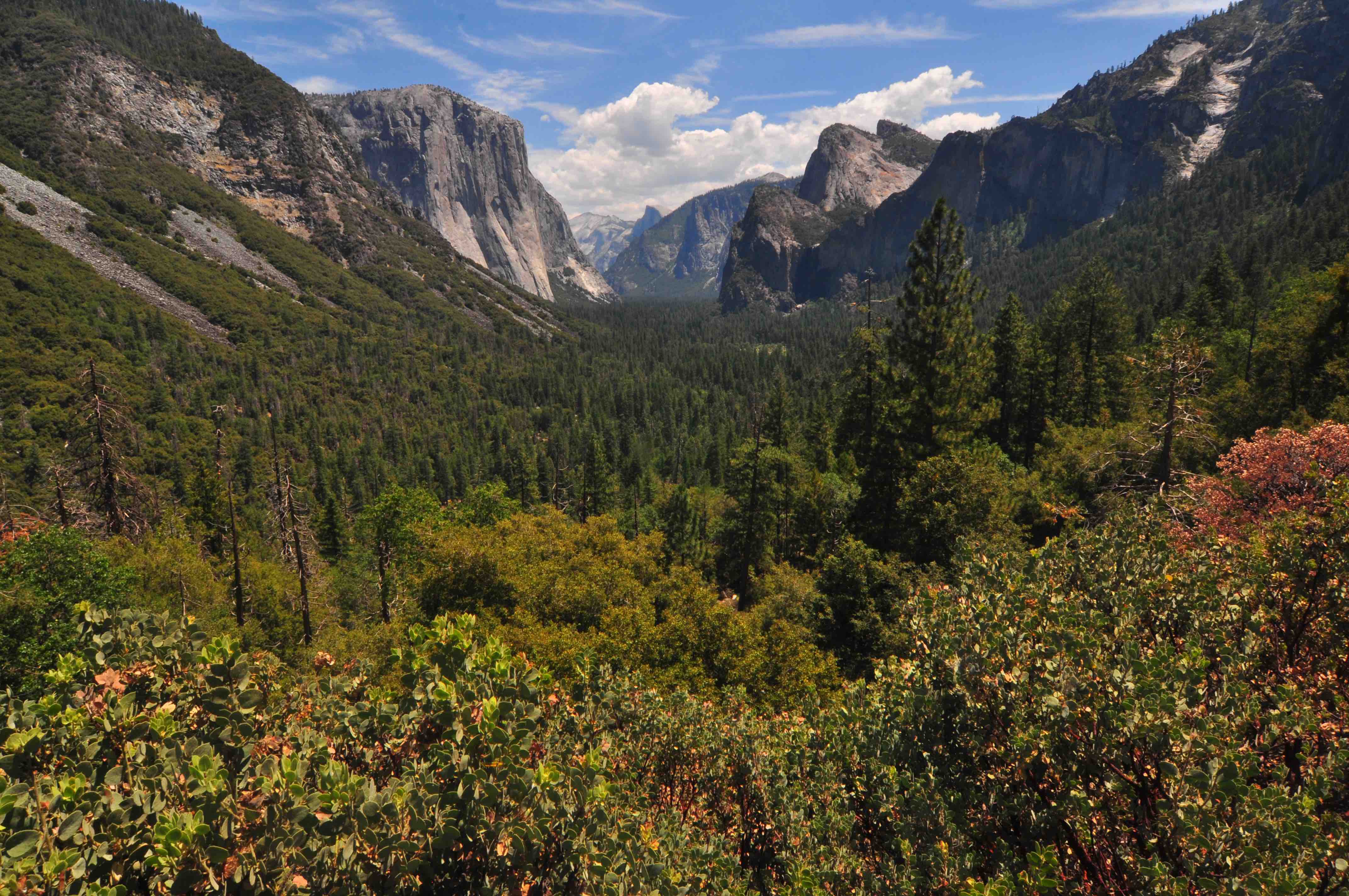
Yosemite Tunnel View
At the western entrance to Yosemite Valley, Tunnel View is a must-do stop, no matter which direction you approach the park from. You’ll find it on the east end of Wawona Tunnel along Wawona Road, which is also Hwy. 41.
Here you can take photos of the most famous panorama of Yosemite Valley, perfectly framed by a forest of pine trees and wide-open skies above.
The vista from Tunnel View is one of Yosemite’s most iconic scenes, made famous by an Ansel Adams photograph. From the Wawona Tunnel’s eastern side, shoot your own postcard-panorama of Yosemite Valley, El Capitan, Half Dome, and Bridalveil Fall. Or hike the Pohono Trail uphill for an even bigger view where you can enjoy the scenery in relative solitude.
Cooks Meadow
Cook’s Meadow is one of my favorite viewpoints. I love the way Half Dome looks with the old tree in the foreground, and it was photographed many times by Ansel Adams as well. For added awesomeness, go to this spot when there is snow. The snow adds a lot to the view, especially at sunset.
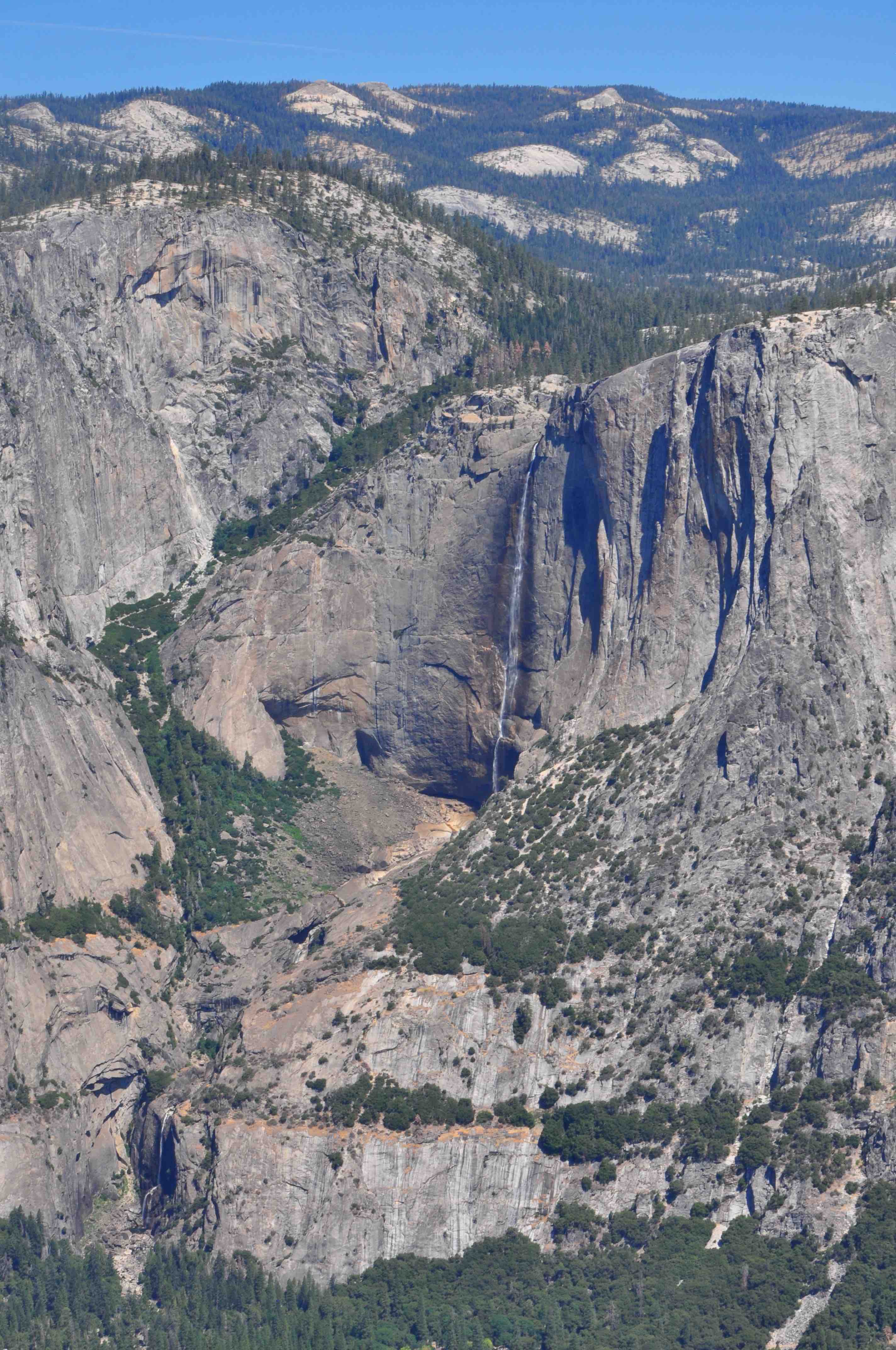
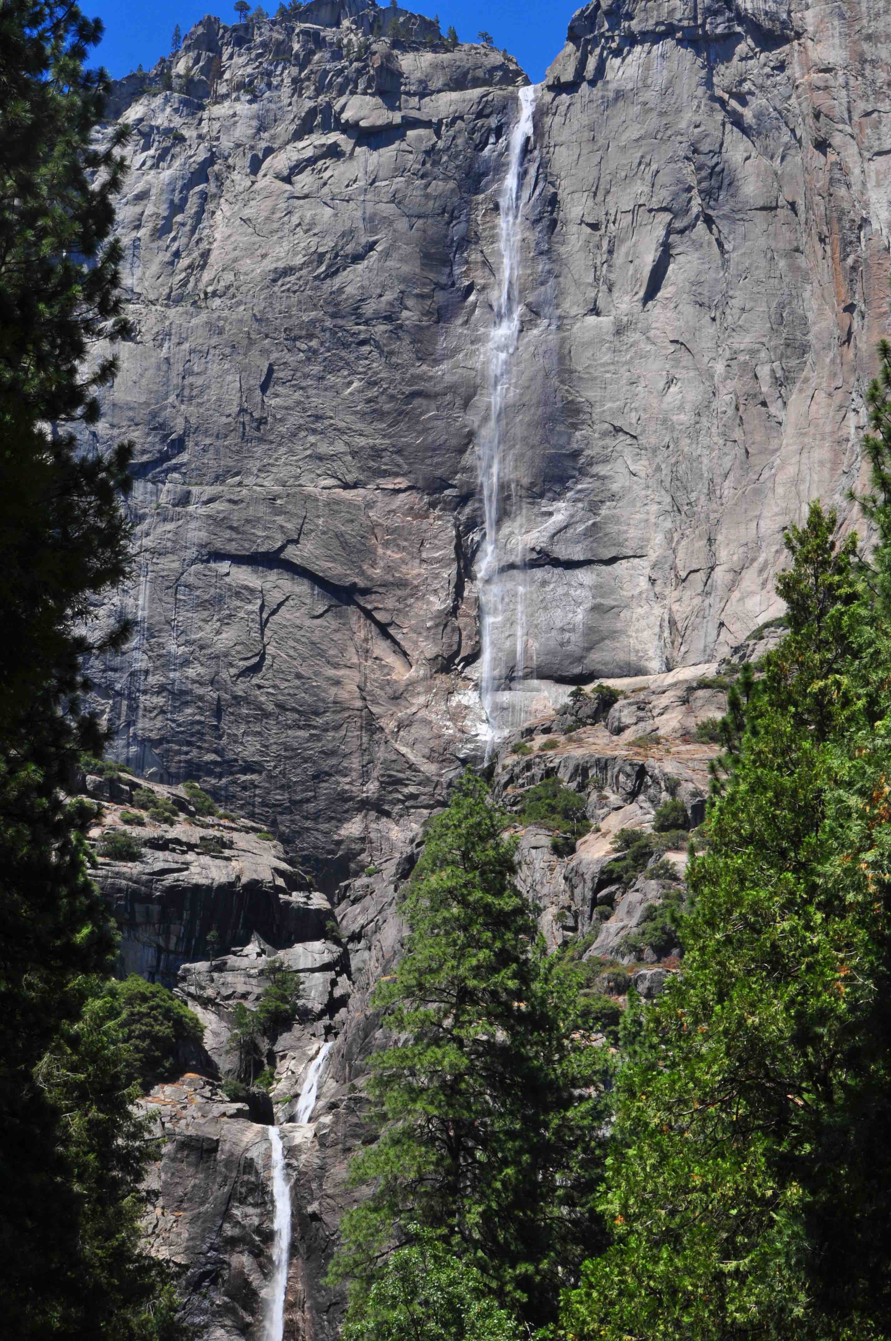
Yosemite Falls
Discover the highest waterfall in North America and the sixth largest in the world: Yosemite Falls. At 2,424 feet, the waterfall is a major attraction in the park, located in the central Sierra Nevada mountain range of California. It’s best viewed in late spring when snowmelt flows most vigorously.
Upper, Lower, and Middle Yosemite Falls combined make up the highest waterfall in North America, topping out at a prodigious 2,425 feet. A challenging trail accesses the upper fall’s crest, but the base of the lower falls can be visited with an easy stroll. From April to June, wear rain gear—an icy spray drenches all who come near. A lightweight Columbia Watertight II Rain Jacket
is a good option to stay dry.
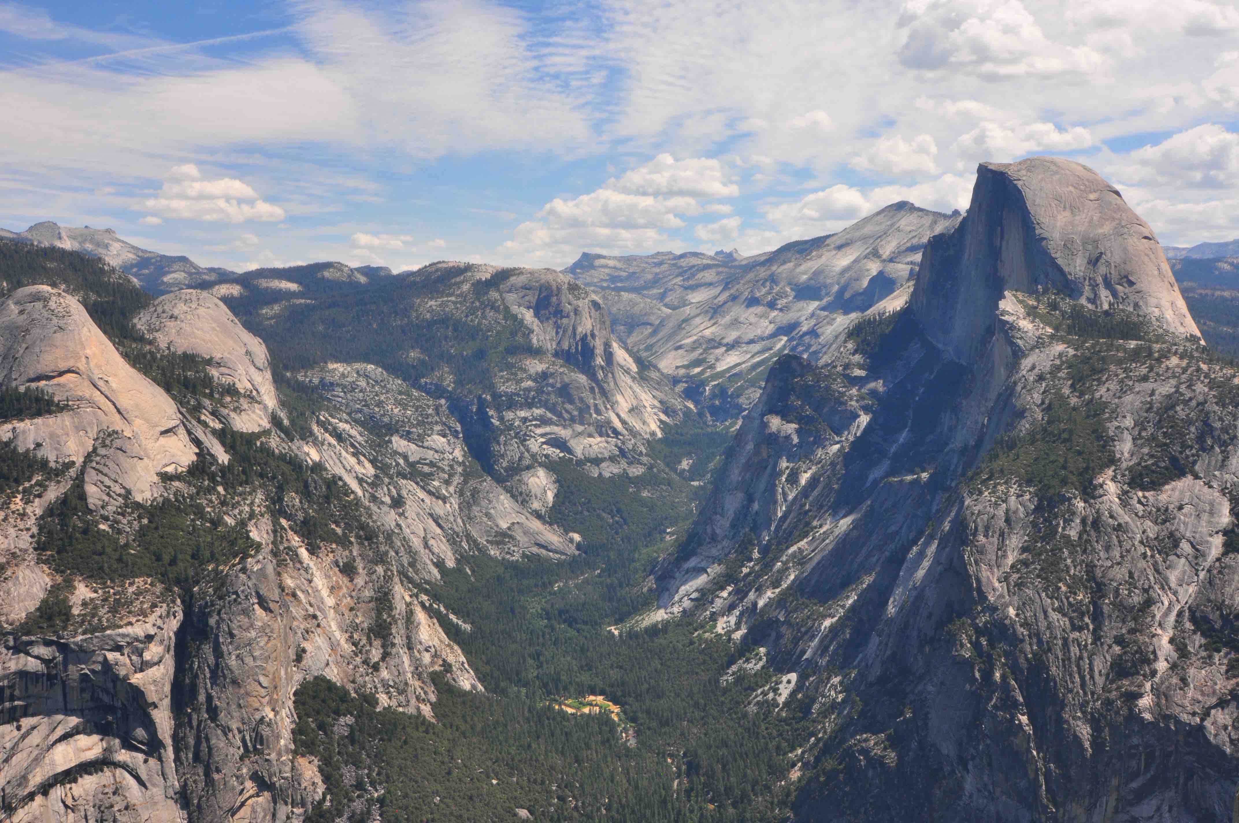
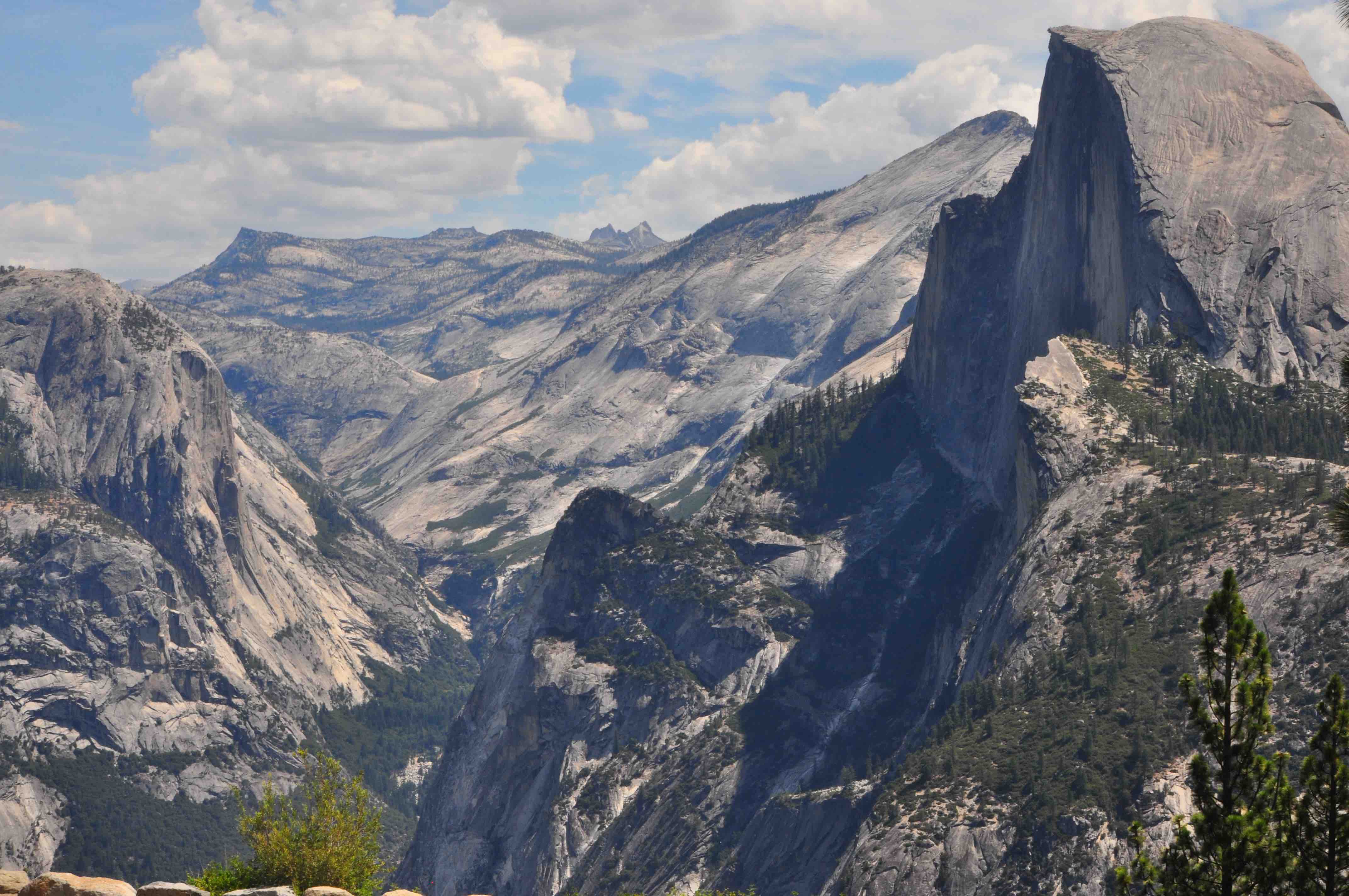
Half Dome
Half Dome
The granite dome in the background is Yosemite’s most popular rock formation: Half Dome. The granite crest rises more than 4,737 feet above the valley floor and hikers can ascend it with the use of cables.
One of the West’s most photographed landmarks, Half Dome inspires awe from every angle. Hardcore hikers can trek to its summit (permits are required); everybody else can admire its sheared-off granite from afar. Check out the perspective from Mirror Lake at the base of the stone monolith or drive up to the Washburn Point overlook on Glacier Point Road.
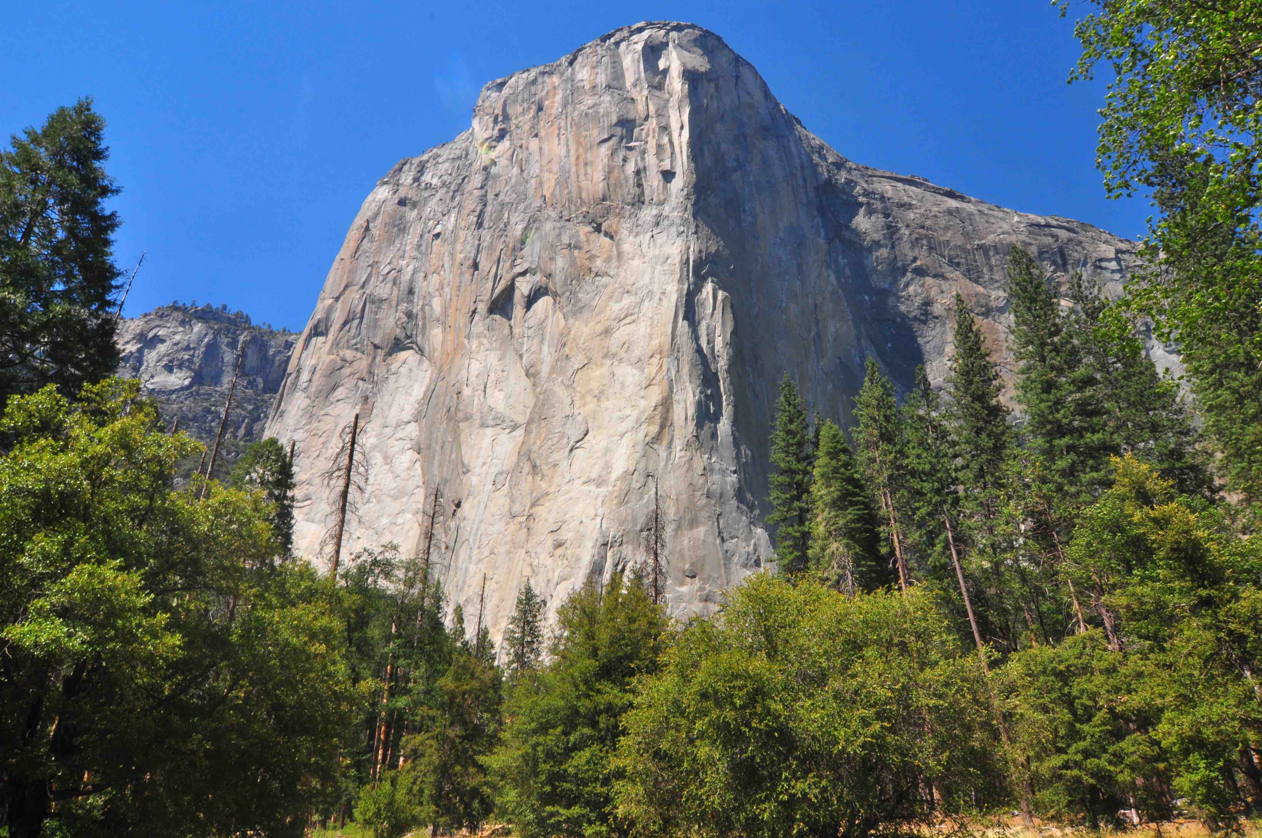
El Capitan Meadow
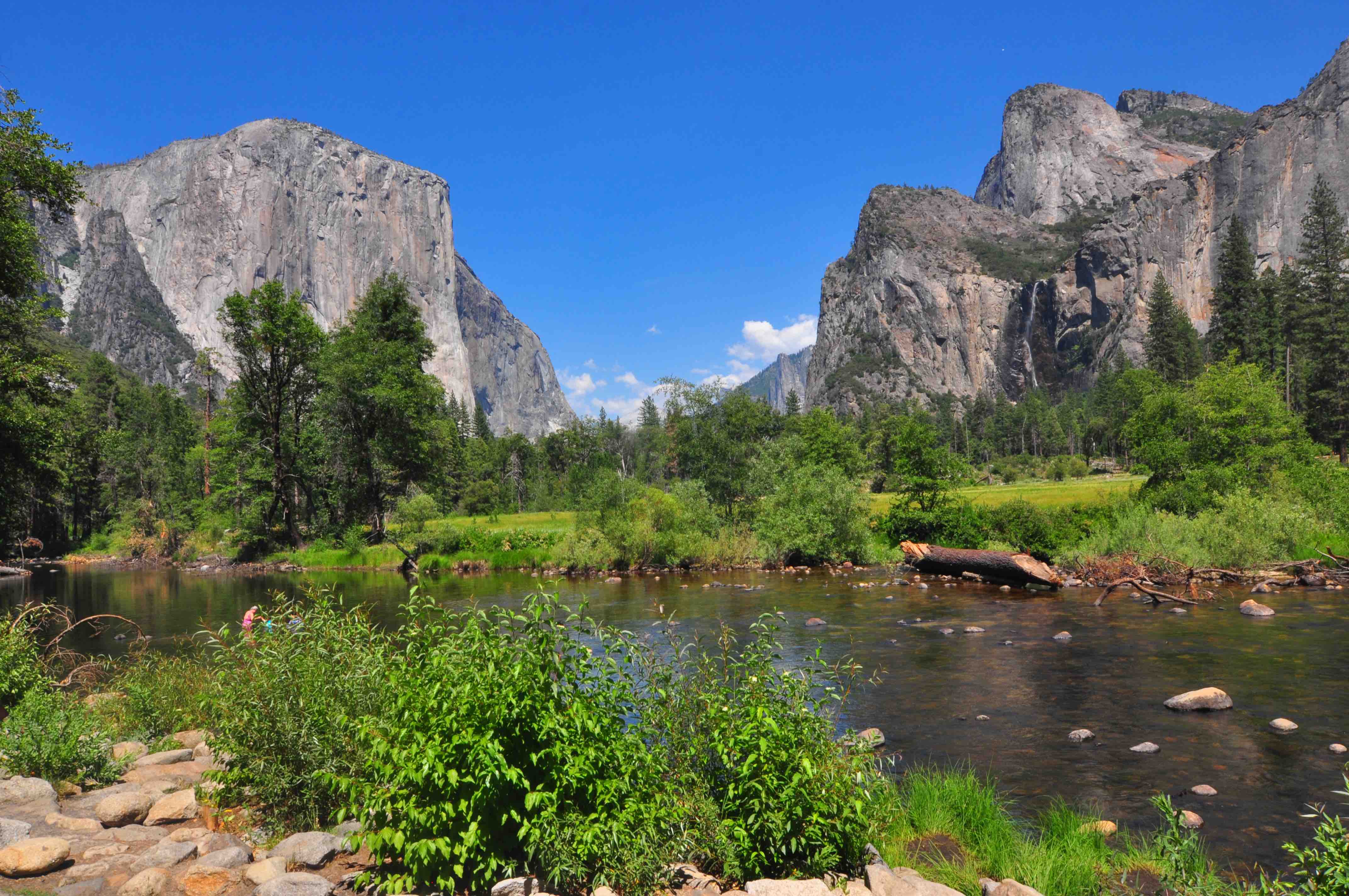
Yosemite Valley View
As you leave Yosemite Valley to see the Mariposa Grove of Giant Sequoias in Wawona near the South Entrance, stop at this roadside lookout along one-way Northside Drive right before you reach Pohono Bridge.
You’ll see the Merced River (something missing from the earlier Tunnel View), flanked by El Capitan, which reaches 3,000 feet up to the sky, and opposite it, the imposing Cathedral Rocks and Spires.
Rock climbers will find few vertical rock formations as challenging as El Capitan (left, background). At one time “El Cap,” which stretches roughly 3,000 feet from base to top, was considered impossible to climb. Today, the most popular route to tackle is The Nose, which follows the rock’s huge projecting front.
Thank the 145-mile-long Merced River: It’s responsible for carving out the glacial valley known as Yosemite Valley. The valley is about eight miles long and a mile deep, with an amazing vantage point offered at Valley View. This turnout is located near the park exit, traveling west on Northside Drive.
Travel Tips
- Entry is free if you have an Interagency Pass
- Buy America the Beautiful Annual Pass, if you are planning to visit more than 4 national parks in a year
- Make sure your park pass is displayed clearly in your vehicle.
- Sometime based on conditions the park may enforce a separate reservation for entry, so make sure to check the latest updates